Vor einigen Wochen (im Sommer 2019) gab es in den Medien einen riesigen Wirbel um Waldbrände im Amazonasgebiet. Schlimm genug, dass dort alljährlich große Flächen in Brand gesteckt werden, da gibt es keine Beschönigungen. Aber leider scheint dies die etablierte Methode der dort ansässigen Bauern zu sein, um ihre Felder vorzubereiten und zu düngen. Nicht gerade sehr nachhaltig. Skandalös war die Instrumentalisierung durch Klimaaktivisten. Hitze, Dürre – der Universalschuldige CO2 war schnell aufs Podest gehoben. Zum Glück zögerten die Regenwaldexperten nicht lange und informierten die Öffentlichkeit über die wahren Zusammenhänge. Hier eine Pressemitteilung der University of Kansas vom 12. September 2019. Die Forscher geben zu Bedenken, dass sämtliche Brände im Amazonasgebiet menschengemacht sind. Die schlimmsten Feuerjahre waren 2005, 2010 und 2015, da Dürren die Ausbreitung der Brände beförderten.
Satellite study of Amazon rainforest land cover gives insight into 2019 fires
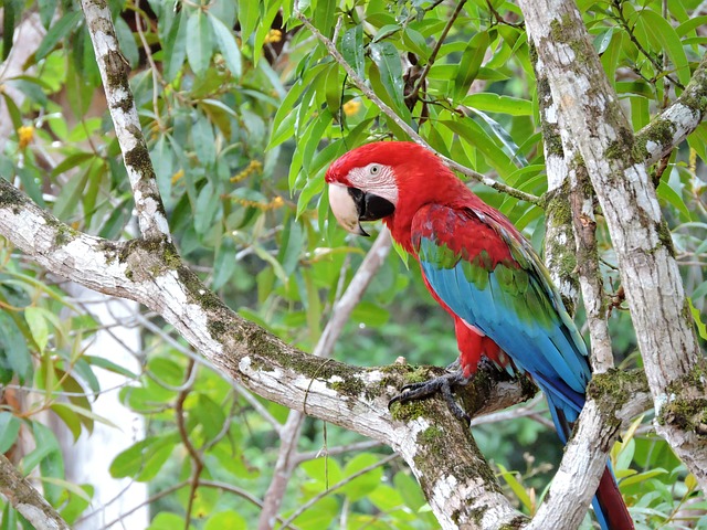
Throughout August and early September 2019, media around the world have reported on the extensive forest fires ravaging Brazil’s Amazon rainforest. Much of the concern stems from the Amazon’s significance to regulating the world’s climate. According to the Associated Press, the Amazon absorbs 2 billion tons of carbon dioxide every year — about 5% of global emissions. Thus, fires in the region eat away at this carbon-absorbing capacity while at the same time adding carbon to the air through burning.
A recent study in the peer-reviewed journal Ecohydrology headed by University of Kansas researcher Gabriel de Oliveira gives important context to the fires burning big swaths of the Amazon today, most of which were set intentionally by farmers and ranchers to convert forest into land suitable for grazing animals or growing crops. The researchers sought to discover how these changes to land cover affect the exchange of water and heat between the surface of the Amazon and the atmosphere overhead.
„This is the first study to examine the biosphere-atmosphere interactions in the Amazon with such high spatial resolution satellite imagery,“ said de Oliveira, a postdoctoral researcher in the Department of Geography & Atmospheric Science at KU. „We tried to understand the impacts of land-cover changes and deforestation in general. When you clear-cut the forests, and you convert it either to pasture or agriculture — or cut the forest, but for some reason don’t plant anything and then have a type of vegetation called ’secondary succession‘ — our idea was to try to understand how that impacts energy, like the radiative fluxes and water fluxes, or evaporation in general.“
In the paper, de Oliveira and his colleagues analyzed information from both satellites in space and weather stations on the ground in the Amazon. With data from the Advanced Spaceborne Thermal Emission and Reflection Radiometer (ASTER) and Large Scale Biosphere Atmosphere Experiment in Amazonia (LBA), they examined surface energy and water changes over different land cover types in one wet year and one drought year in eastern Rondônia state, Brazil. The team also found statistically significant differences in several important measures prior to and after one year of deforestation.
„Using NASA satellite images with high spatial resolution (15m) obtained by the ASTER sensor in Rondônia state, in the south-western Brazilian Amazon, we found that deforestation and consequent transition to pasture or agriculture to grow soybean tend to increase in two to four times the soil and air temperatures in the region,“ de Oliveira said. „We also observed an approximately three times higher evapotranspiration over forested areas in comparison with nonforested areas.“
The researchers discovered significant variances between areas on opposite sides of the Ji-Paraná River, one side of which had suffered more deforestation than the other side, located within the Jaru Biological Reserve protected area. They measured spatial variation of albedo (or the fraction of the incident sunlight that the surface reflects), net radiation (or the total energy, derived from sunlight, that’s available at the surface), soil and sensible heat fluxes (or how much heat is transferred from the surface to the atmosphere), and evapotranspiration (the process by which water is transferred from the land to the atmosphere by evaporation from the soil and by transpiration from plants).
De Oliveira, who was raised in Brazil, said the rest of the world depends on the Amazon region to help moderate global climate.
„It’s important because it’s the largest rainforest in the world,“ he said. „Precipitation in the tropics, all the water fluxes that go on in the tropics, affect the whole world. The Amazon has a very important role in that. There’s no other area in the world like the Amazon’s unique ecosystem. It’s pretty fascinating. I’m from South Brazil, a totally different environment than the Amazon. You could compare it with Kansas. But when I started studying for my master’s degree, my adviser told me, ‚You’re going to work in the Amazon rainforest.‘ And I told her I’d never been there. But I spent two months in the rainforest doing research. And of course, you know, I fell in love. I’m very passionate about the Amazon and have been there so many times since then, so I have a lot of experience and stories of things that have happened there.“
The KU researcher cautioned that although forest fires in the Amazon have received attention in the media this year, the fires happen to a greater or lesser degree every year. „Fires in the Amazon happen every year during the dry season,“ de Oliveira said. „We have agricultural areas, areas that were deforested in the past — but in order to clear the area for the next year, or to make the soil a little bit better for the next year, they set a fire. They claim they’re only setting fire to burn agricultural lands. But sometimes the fire gets out of control, and it plays a part in more deforestation. Fires get out of control in agricultural land and reach the forest and burn the forest. But these fires happen in the Amazon every year, so it’s pretty straightforward. The worst years were in 2005, 2010 and 2015 because of severe drought events. Everything was really dry, and the fires would get out of control. There are no natural fires in the Amazon. They’re all set by human beings.“
De Oliveira’s co-authors on the study were Nathaniel Brunsell, professor and chair of KU’s geography & atmospheric science department; Elisabete Moraes, Yosio Shimabukuro, Celso von Randow and Luiz E.O.C. Aragao of the Brazilian National Institute for Space Research; Thiago dos Santos of the University of Michigan and Renata de Aguiar of the Federal University of Rondônia.
Lars Fischer schrieb in Spektrum der Wissenschaft zum Thema am 23. September 2019:
Was die Amazonas-Brände wirklich bedeuten
Etwa 40 000 Feuer brennen nach Angaben von Brasiliens Weltraumforschungsagentur INPE im weltgrößten Regenwaldgebiet, dem Amazonasbecken. Die Brände in dem Land sind so verbreitet, dass sie Erinnerungen an die enormen Megafeuer der Arktis wecken, die dieses Jahr ebenfalls Schlagzeilen machen. Doch nicht alles ist, wie es auf den ersten Blick erscheint – so sind die Brände von 2019 keineswegs die größte Feuersbrunst, die der Amazonas-Regenwald je erlebt hat, und anders als in der Arktis ist hier nicht der Klimawandel am Werk.
Letzteres zeigt sich im Vergleich zu 2016, einem Jahr, in dem fast so viele Feuer brannten wie derzeit. Der dramatische Unterschied: 2016 war eines der El-Niño-Jahre, die im Amazonasbecken schwere Dürren und mehr Feuer bringen. Die Brände in diesem Jahr erreichen ihr Ausmaß ganz ohne meteorologische Unterstützung. Dennoch hat sich die Feuersaison angekündigt. Nicht in Wetter- oder Klimamodellen, sondern in der Politik – Begeisterung für die Abholzung der Wälder ist das umweltpolitische Markenzeichen des brasilianischen Präsidenten Bolsonaro.
Weiterlesen in Spektrum der Wissenschaft
Der Hinweis von Lars Fischer auf die Beteiligung des Wetterphänomens El Nino ist ausgezeichnet. Die Zusammenhänge zwischen El Nino und den Bränden in tropischen Regionen werden immer deutlicher. Nachzulesen zum Beispiel bei Chen et al. 2017 in Nature Climate Change:
A pan-tropical cascade of fire driven by El Niño/Southern Oscillation
The El Niño/Southern Oscillation (ENSO) has a pronounced influence on year-to-year variations in climate1. The response of fires to this forcing2 is complex and has not been evaluated systematically across different continents. Here we use satellite data to create a climatology of burned-area and fire-emissions responses, drawing on six El Niño and six La Niña events during 1997–2016. On average, reductions in precipitation and terrestrial water storage increased fire emissions in pan-tropical forests by 133% during and following El Niño as compared with La Niña. Fires peaked in equatorial Asia early in the ENSO cycle when El Niño was strengthening (Aug–Oct), before moving to southeast Asia and northern South America (Jan–Apr), Central America (Mar–May) and the southern Amazon (Jul–Oct) during the following year. Large decreases in fire occurred across northern Australia during Sep–Oct of the second year from a reduced fuel availability. Satellite observations of aerosols and carbon monoxide provided independent confirmation of the spatiotemporal evolution of fire anomalies. The predictable cascade of fire across different tropical continents described here highlights an important time delay in the Earth system’s response to precipitation redistribution. These observations help to explain why the growth rate of atmospheric CO2 increases during El Niño3 and may contribute to improved seasonal fire forecasts.
Wer gerne selber Fakten checkt, dem sei die Webseite globalfiredata.org empfohlen. Dort kann man das Amazonasgebiet auswählen und interaktive Statistiken zur Waldbrandhäufigkeit abrufen. Das Jahr 2005 übertrifft alle anderen Jahre der letzten anderthalb Jahrzehnte deutlich.
Und hier noch der Langzeitkontext. Power und Kollegen haben 2016 die Waldbrandhäufigkeit eines bolivianischen Regenwaldabschnitts für die vergangenen 12.000 Jahre untersucht. Zwischen 8000-7000 Jahren vor heute brannte es dort besonders oft. Danach wurde es wieder besser. Die Autoren weisen auf diese bewegte Waldbrandgeschichte hin und stellen fest, dass der Urwald wohl robuster ist als gedacht, da er sich immer wieder regeneriert hat. Hier der Abstract:
Fire, climate and vegetation linkages in the Bolivian Chiquitano seasonally dry tropical forest
South American seasonally dry tropical forests (SDTFs) are critically endangered, with only a small proportion of their original distribution remaining. This paper presents a 12 000 year reconstruction of climate change, fire and vegetation dynamics in the Bolivian Chiquitano SDTF, based upon pollen and charcoal analysis, to examine the resilience of this ecosystem to drought and fire. Our analysis demonstrates a complex relationship between climate, fire and floristic composition over multi-millennial time scales, and reveals that moisture variability is the dominant control upon community turnover in this ecosystem. Maximum drought during the Early Holocene, consistent with regional drought reconstructions, correlates with a period of significant fire activity between 8000 and 7000 cal yr BP which resulted in a decrease in SDTF diversity. As fire activity declined but severe regional droughts persisted through the Middle Holocene, SDTFs, including Anadenanthera and Astronium, became firmly established in the Bolivian lowlands. The trend of decreasing fire activity during the last two millennia promotes the idea among forest ecologists that SDTFs are threatened by fire. Our analysis shows that the Chiquitano seasonally dry biome has been more resilient to Holocene changes in climate and fire regime than previously assumed, but raises questions over whether this resilience will continue in the future under increased temperatures and drought coupled with a higher frequency anthropogenic fire regime.